

Learning from Home
Normally, the Skyscraper Museum offers Family Program on Saturdays that give kids and parents a chance to see and be inspired by our models, drawings, and more in our gallery, then make their own creative skyscraper designs and city plans. But these are not normal times, so the Museum has adapted some of its resources and activities to Learning at Home! We've created a toolbox of activities for kids to draw from that spark the imagination and engage critical thinking by bringing New York City indoors.
We challenge our young architects, builders, and engineers to respond to real-world questions by drawing from school and world-based knowledge. Through math, science, creative writing, and arts & crafts we offer numerous ways to transform household materials into personalized cities. With content on skyscrapers, NYC history, urban environments, and architecture, we hope your families discover new avenues of thought and new corners of our city!
Activities:
Shapes and Skyscrapers


A shape is a two dimensional figure, with length and width. Some common shapes you may know are geometric, such as circles, triangles, squares, and rectangles. Shapes are found all around us, from buildings to clouds. Shapes can appear naturally, such as on the shell of a turtle or inside a flower. They can also be created or built. Take a look at a stop sign. What shape do you see? If you guessed octagon, you are correct! Shapes make up our built world, which includes buildings, parks, and bridges. Shapes can be seen in the first design of a skyscraper on blueprints, the plan for the building, and after the skyscraper is built. Skyscrapers have a lot of unique shapes from the outside of the building to the floors inside.
New York City is a treasure chest of hidden shapes because the city has many skyscrapers! Our exercises are perfect for elementary to middle school students and range from simple to complex shapes. We introduce concepts about skylines, floor plans, and blue-prints that make understanding shapes in architecture easier. Skyscrapers can serve as examples in mathematics, science, and history. Our "brain games" focus on dimensions and patterns on the interior and exterior of buildings. Beginning with The Skyscraper Museum’s home in NYC we then turn to some of the tallest skyscrapers in the world. By comparing skyscrapers across time, from the 1920s-2020, and across the globe, our activities encourage students to recognize patterns across our built environment. Let’s start our treasure hunt for shapes on the New York City skyline!

Visit our Supertall website to discover more details about these skyscrapers and to find more shapes in their floor plans and silhouettes!
Exercise 1: Shapes Scavenger Hunt
In this exercise, we will discover different shapes in the skyscrapers on our Supertall Lineup. Supertall skyscrapers are those that are at least 1,250 feet or 380 meters. For the following supertall buildings, try to find circles, semi-circles, squares, rectangles, triangles or other polygons in their designs and floor plans. For more pictures, please click the link and select the skyscraper on the lineup.
Fun Fact: The Burj Khalifa was inspired by a flower! Remember we said shapes can be found in our natural and built world? This tower, designed by architect Adrian Smith, looks like a regional desert flower named the Hymenocallis or Spider Lilly. Architects not only design skyscrapers from abstract shapes, but also from shapes inside nature!


Exercise 2: Shapes Scavenger Hunt 2

A lot of shapes can be found in the floor plans of skyscrapers. Each of these shapes represents the base and the inside of a building. A floor plan is a representation of one story or floor of a building. Looking at these examples, the floor plan of the Lakhta Tower looks like a star with a circle inside. That means the outside shape of the Lakhta Tower appears like a star if you look down at the building from up in the air, from an aerial view. The circle represents the shape of one floor inside of the building. Each floor of a skyscraper has a floor plan that represents where the rooms are located.
Imagine what your house or apartment building would look like if you took a photograph of it from a “bird’s eye view,” from high up in the sky. Your home would probably be shaped like a square or rectangle. Now pretend you wanted to slice up your home by floors. The layout of each floor, where your bedroom, bathroom, and kitchen are laid out would be represented in a floor plan. Depending on how many floors are in your building, your floor plan may have many floors! The images to the left show only one floor of each building.
Keeping in mind what you learned in the previous exercises, how many shapes can you find in these floor plans? Some plans are simple - either a circle or a square. Others are much more complex! See how many simple shapes you can find in a floor plan shaped like a star or a rectangle with rounded corners, especially if you start overlapping shapes on top of each other!
Now that you’ve found all the shapes, let’s match the floor plans to the buildings above! What are some of the most popular floor plan shapes? Here are some examples, but there are more!
Exercise 3: Shapes in the Skyline


Every building is made up of shapes! For example, look at teh Chrysler Building — especially its top, called the "vertex." We've traced a few shapes over this image of the vertex to help show you how it's actually a pyramid made up of semi-circles and triangle windows! But there are many more shapes in this image. Can you find more?
Using the example of the vertex here, use the full-length image of the Chrysler Building below and find as many shapes as you can. Tip: print out the photograph and draw over it. More information on the Chrysler Building can be found here: http://old.skyscraper.org/EXHIBITIONS/TEN_TOPS
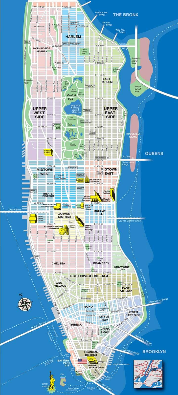
Look at this photograph of New York City’s skyline in the 1920s. Though it was 100 years ago, New York City was already full of tall buildings. A skyline is a horizontal view of buildings and land. Horizontal means side to side or across the horizon. New York City’s skyline has a lot of vertical lines because the city has a lot of skyscrapers! Vertical means up and down towards the sky and ground. Some of the buildings in the photograph below are still standing today!https://skyscraper.org/featured/learning-from-home/

When you look at this picture, what do you see? A fun and easy way to understand the NYC skyline is to find all the shapes you know. In this picture, there are a lot of shapes! There are mostly rectangles, but see if you can find some triangles, or even a circle. We helped you get started by finding some shapes below. Can you find some we missed?

Now that you’ve found some more shapes here, it’s time to look at New York City’s skyline today and find more shapes! Though the 1920s skyline and the 2020 skyline look very different, what shapes look the same? What buildings are new to the 2020 skyline? What do you notice about the tops of the buildings in the 2020 skyline? What shapes do you see?

Exercise 4: Draw New York City’s Skyline Using Shapes
A skyline may seem like a complex scene. However, it is composed of a series of simple shapes. In this activity, we will use common shapes to draw our own favorite skyline!
Materials
- Paper
- Markers/colored pencils
- Scissors (optional)
- Tape (optional)
Instructions:
Step 1: On a piece of paper, create a horizontal line, make sure to leave room at the bottom of the page.
Step 2: Draw rectangles of different widths and sizes, some rectangles can be in front of others to give depth.
Step 3: Add other shapes to the rectangle tops. Make each one a little different, use triangles, squares, circles etc.
Step 4: Draw details on each building, such as small squares that resemble windows.
Optional:
Step 1. Cut along the top of the buildings
Step 2. Fold along the horizontal line
Now you can display your skyline against different backgrounds.
We would love to see your artwork. Once you finish, please share a photograph of your creation @skymuseum on Twitter and/or @skyscrapermuseum on Instagram!
Green Buildings
Activity: Turn a NYC Skyscraper Green!
In the Museum’s Garden City I Mega City exhibit, we explored how design can tackle global warming by focusing on the work of the Singapore-based architectural firm WOHA. Founded in 1994 in the Malaysian city-state of Singapore by the partners Wong Mun Summ and Richard Hassell, WOHA has been a pioneer in incorporating nature into their buildings to make them more sustainable and beautiful.
In New York City, the idea of GREEN skyscrapers have only recently become popular. Drawing from some of WOHA’s projects and a New York City skyscraper now under construction, called The Spiral, we challenge you to select a skyscraper in New York City and transform it with natural elements!
Design Examples

Oasia Downtown, Singapore
Responding to Singapore’s equatorial climate and dense urban conditions, WOHA designed the high-rise hotel Oasia to incorporate nature in both its large, multi-story interior courtyards and in a living, green facade.

The tower features three stacked “Breezeway Atria” surrounded by L-shaped blocks of hotel rooms and offices. Each segment is landscaped and treated as an internal veranda. Landscaping is also vertical, In contrast to popular glass curtain-wall skyscrapers in the city, this building's facade is a perforated metal screen that creates a permeable wall for climbing plants to turn the red tower green with foliage.
Video: WOHA https://youtu.be/EqF1Few53iU

Skyville@Dawson, Singapore
WOHA's public housing project SkyVille@Dawson is a public housing project that addresses the themes of community and sustainability. Three 47-storey towers are designed around ‘Breezeway Atria’ that are cooled and ventilated by natural means of creating breezes by air flow in shaded areas.

Every dwelling unit belongs to a ‘Sky Village’ with 80 homes. A total of 12 villages (960 homes) are stacked in four layers across the 3 interconnected blocks. To maintain a sense of human scale, every village shares a communal ‘Sky Terrace’ every 12 floors. A communal ‘Sky Park’ on the roof, and extensive public parkland at ground level contributes to the High-Density/ High-Amenity concept of the development.
Video Production: Xtreme Media; Drone Videography: K.Kopter; Skyshot; Time Lapse Photographer/Videographer: Keith Loutit.


The Spiral, New York City
The Spiral is a 1,041 ft/ 317m office building under construction in the expanding Hudson Yards district west of Midtown Manhattan. The design by BIG (Bjarke Ingels Group) is a steel and glass skyscraper that incorporates nature in landscaped terraces that wind around its 66 stories, giving office workers on every floor access to an outdoor garden.
The towers's form, which tapers as it rises, draws on the history of New York's skyscrapers of the 1920s that were shaped by the city's new zoning regulation which required a series of setbacks as the building grew taller. Here are some examples of gardens on the roofs of skyscrapers drawn by the architectural delineator Hugh Ferriss in the early 1920s!
Here are some examples of gardens on the roofs of skyscrapers drawn by the architectural delineator Hugh Ferriss, author of The Metropolis of Tomorrow (1929). For more visions of the future city, see the exhibition New York Modern (See here to learn about the case of the Rockefeller Center)
Watch the video to see BIG's inspiration from both nature and New York City history.
Activity 3: Take a Virtual Walk of Battery Park City!
Battery Park City Virtual Walk Itinerary

Itinerary: You’ll start at The Skyscraper Museum.
- Skyscraper Museum, 39 Battery Place
- Battery Park City School, 55 Battery Place
- Robert Wagner Park and Pavilion, 20 Battery Place
- World Financial Center/Brookfield Place, 230 Vesey Street
- The Verdesian, 211 North End Avenue
- Tribeca Green, 325 North End Avenue
- Solaire, 20 River Terrace
- One River Terrace, 1 River Terrace New York
Let’s meet at Battery Place and First Place!
Battery Park City Virtual Tour
Battery Park City is one of the many landfill extensions that redefined Manhattan’s shoreline. Michael Kimmelman’s New York Times article, “When Manhattan Was Mannahatta: A Stroll Through History” looks at the island’s transformation from a swath of lush forestry and freshwater basins to the world-class city we know today, based on Eric W. Sanderson’s 2009 book Mannahatta: A Natural History of New York City. According to Sanderson’s account, the west side of the island was once a strip of white sand beach stretching from Lower Manhattan to 42nd Street and later rebuilt to expand the reaches of the borough; to learn more about the Manhattan’s geographic history, the Welikia Project provides a map-based interface that envisions the physical evolution of the island. Battery Park City sought to reintroduce the terrain that once characterized the island as a central design element for livable and environmentally responsive spaces for the city’s growing population.

Top left: the current location of The Skyscraper Museum. Top right: Outline of the waterfront esplanade in Battery Park City. Bottom left: modern day Manhattan superimposed on original landmass. Bottom right: Manhattan as it appears today.
Source: Welikia
Battery Park City Authority introduced the Residential Environmental Guidelines in 2000 followed by the Commercial/Institutional Environmental Guidelines in 2002, setting environmental design guidelines that led to the construction of many buildings ahead of the current standards. The Battery City Park School is one building constructed under these codes. To adapt to the evolving times of climate resiliency, the agency passed a 10-Year Sustainability Plan on April 22, 2020, outlining the community’s capital improvements and programs goals towards a sustainable future. The agenda is broken down into four sections -- energy, water, waste and site actions -- detailed from page 34 to 98. As a result of these cumulative efforts, Battery Park City is famously known as one of the first “green communities” and a model for urban development.
With our virtual green tour, you can explore the neighborhood from home through Google Earth and plan your future visit.
Do you know which way is north? If yes, face that way! You should see an orange and tan building with a needle pointing upwards.
Now, look to your right and you will see the Skyscraper Museum. This is the first stop of our tour. 39 Battery Place became the museum’s permanent location in Battery Park City in March 2004. The museum shares the building with The Wagner Hotel in Battery Park City.
The next stop on our virtual tour is right across the street at the Battery Park City School north of the museum.
Do you notice any colors on the outside of the building? If you answered orange red, you are correct. The outside of the school is made of bricks placed on top of each other in a pattern.
Although the building looks very long, it is actually on top of a small city block!
Do you know what makes the building stand up? It has pieces of steel and concrete that make up its skeleton! It is like the human skeleton, our bones, that make us stand. But steel and concrete take a lot of power to make. Remember we said buildings in Battery Park City have to follow a green code? To make sure we don’t waste power making these materials, the school is made of 10% recycled matter.


The steel skeleton of the Battery Park School provides a very strong frame made up of hundreds of steel pieces. If you look at the picture on the far left, you can see what this frame looks like before walls and floors are built on around them. For high-rise buildings, steel-frame construction is quick to erect, uses less resources, and allows more of the walls to be open for windows to bring as much sunlight inside as possible. If you want to know more, check out our Green School Lesson Plan here!


Model of early design for Wagner Park and Pavilion, 1993. Machado Silvetti, collection of Battery Park City Authority.
From the school, we will walk south along Battery Place to Robert F. Wagner Jr. Park.
Located southwest across from the Skyscraper Museum, Robert F. Wagner Jr. Park is a public park by the water with beautiful views of the Statue of Liberty and New York Harbor. The space has two pavilions connected by a wood bridge surrounded by fields of grass. The pavilions are made of the similar type of brick and pattern as the Battery Park City School we just visited!
The model and framed drawing and in the case to the left are early schemes for the Robert F. Wagner Jr. Park and Pavilion, designed by the Boston-based firm Machado Silvetti. The park, directly across the street from The Skyscraper Museum, opened in 1996. The ensemble of architecture and landscape design, by Hanna/Olin and garden designer Lynden B. Miller, features a grassy plane sloping down to the harbor and framed by two brick pavilions joined by a wooden bridge.
See the exhibition MILLENNIUM with these models and more!
But we can’t stay too long. We will walk north along Hudson River Greenway and head down to our next destination, Brookfield Place. It is about a 5 minute trip. Walk along the river until you come to the marina. Look to the right, and you will see One World Trade Center! Walk around the marina and you will see four skyscrapers surrounding you, all with similar shapes, colors, and materials and a lower glass building with a high vault, the Wintergarden.
Brookfield Place, previously known as World Financial Center, was the first commercial development completed in the community, completed in 1986. The 14-acre complex was designed by the renowned firm Pelli Clarke Pelli Architects, and consists of four office buildings of 34 to 51 floors, the central WinterGarden, a glass court surrounded by stores, and a large public plaza. The two towers leading to the court’s entrance and waterfront have interesting octagon-shaped floor plans. These buildings, called Postmodern in their style, originally contrasted with the extreme height of the shiny, straight-up Twin Towers. Their stepped-up rectangular forms with rounded domes and pyramid-inspired tops relate to the setback skyscrapers of the 1920s and 1930s.
On colder days, it is nice to sit on the court’s grand staircase with the view of the rows of giant Arizona palm trees. During the summer, the plaza is a great place to relax, with different spots to take pictures and eat, especially during sunset. There are art installations, concerts, and various events that are great to explore. This spot is a fun spot for everyone! Let’s take some time to explore the site!
Alright, we stayed long enough. We will continue to our next destination, The Verdesian. To get there, we will walk north along West Street to Murray Street and west to North End Avenue. When you reach the intersection, the building on your left should be your destination.
Like Brookfield Place, the Verdesian is designed by Pelli Clarke Pelli Architects! It was completed in 2006. The 24-story high-rise has 253 apartments and a total of 253,000 sq. ft. of space! The design is inspired from Lower Manhattan’s architecture, with red brick and window patterns found in Tribeca and Soho, and newer glass buildings all around downtown for a modern look. It is the first apartment building to get a Platinum LEED rating. The building uses many energy efficient technologies such as air-filtering, construction material recycling, and water recycling!
Now, we will head to the next location on the tour, Tribeca Green. You can walk one block to Warren Street. The building on the southwest corner is the spot!
Looking at the building, do you notice any familiar colors we saw before? If you answered, red brick from the Battery Park City School and The Verdesian, you are correct. Many buildings in the area have this material on their outer walls. Tribeca Green stands 230 feet tall with 357,000 sq. ft of space. Like previous buildings, this one has 274 apartments. The architect Robert A.M. Stern planned the building. One interesting fact: the developer, Related Companies, is the same as that of the Hudson Yards in Midtown Manhattan!
And yes, you guessed right, this building also has LEED status—Gold ranking. The structure uses many sustainable practices to lower utility bills such that its green roof helps stop water runoff and reuses it in the building’s system!
We will have some fun and move on towards the waterfront. Yes, I know you have been waiting. We will head to The Solaire. It is one street south from the corner of Warren Street and River Terrace.
Like the previous two, this building also has a two level structure that looks like two stacked boxes. Similar to The Verdesian and Brookfield Place, Pelli Clarke Pelli Architects created the design for this tower. The building has 294 apartments at 283 feet tall. The Solaire is also in the competition for sustainability, with impressive titles! It was awarded the AIA Top Green Project in 2004, the first residential building to get LEED Gold ranking, selected site by the U.S. Department of Energy in the Green Building Challenge, as well as the earliest to receive funding from the New York State Green Building Tax Credit! Some sustainable practices used at the location include reusing water, filtering air, controlling indoor lighting and climate, installing ozone free and natural gas appliances, and recycling construction materials.
This apartment building was completed in 2007. How tall do you think the building is? It looks very tall looking up, but it is only 312 feet tall. What else can you observe about the design of the building? It looks like two rectangle boxes stacked on top of each other, one curved laying flat and the other standing up. If you want to live here, there are 264 units you can choose from. Like many of the sites on this tour, the structure also has LEED gold status, employing many of the technologies mentioned in the previous buildings. It is a very green building even if it doesn’t look green!
We have come to the end of this virtual tour. Hope you enjoyed and learned something today!
Activity 3: Design Your Own Green Neighborhood
As we saw in the time lapse maps at the beginning of Activity 2, the tip of Manhattan has been greatly expanded over time.
Materials needed:
- paper
- markers/colored pencils
- printer (optional)
Imagine that NYC is planning on building a new neighborhood today, similar to how BPC was built in the late 1960s—by expanding the island out into the water.
Think about how you would to add this new neighborhood and why. Would you extend your favorite neighborhood or be a whole new one? What would its shape be and why? Would it be primarily residential, a new business district, a park, or serve a different function? Would you build it to match its surroundings or create a new "natural" waterfront like Battery Park City? There are many questions to consider. Go ahead and give your neighborhood a name—you can even name it after yourself!
Click here to find a downloadable map to print out or trace from.
Your new neighborhood should be built with sustainability in mind, from its street layout to the individual buildings. Draw some streets in your neighborhood, and don’t forget to add parks and open spaces for people that live and work there to enjoy. Take as much time as you want, and don’t forget to look at other NYC neighborhoods to give you ideas. Many architects and developers draw inspiration from other buildings and neighborhoods so feel free to do the same!
Now, think back to all the things you learned about sustainable buildings on the Battery Park City Virtual Tour. What were some of the most interesting green building ideas you learned about? How would these look on buildings in your new neighborhood? Think about whether you would match the materials and design of buildings as seen in the red brick of buildings in Battery Park City. Make your design exciting and sustainable!