


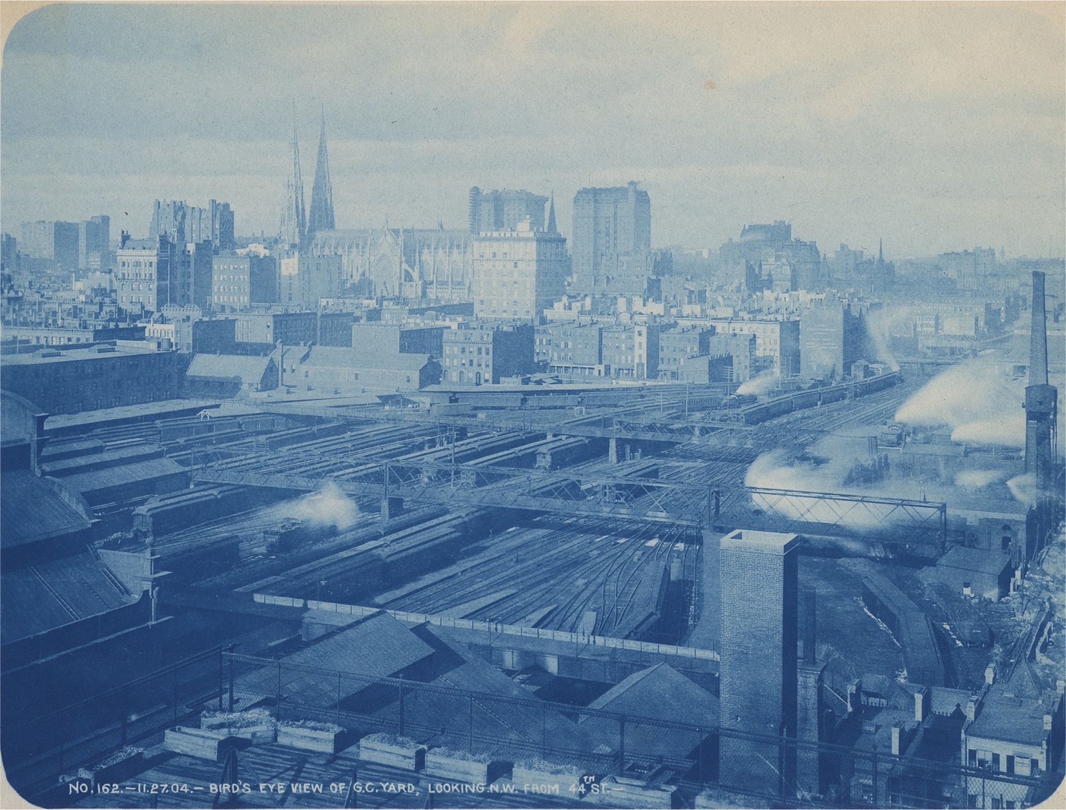
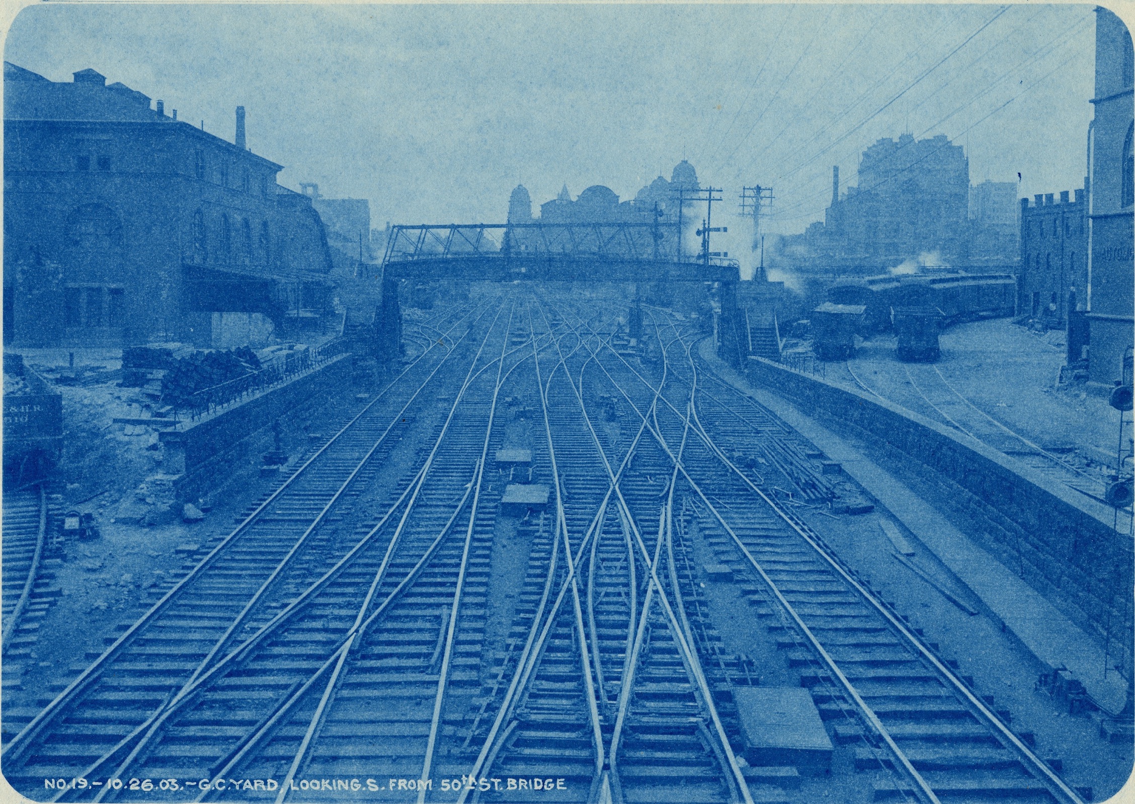
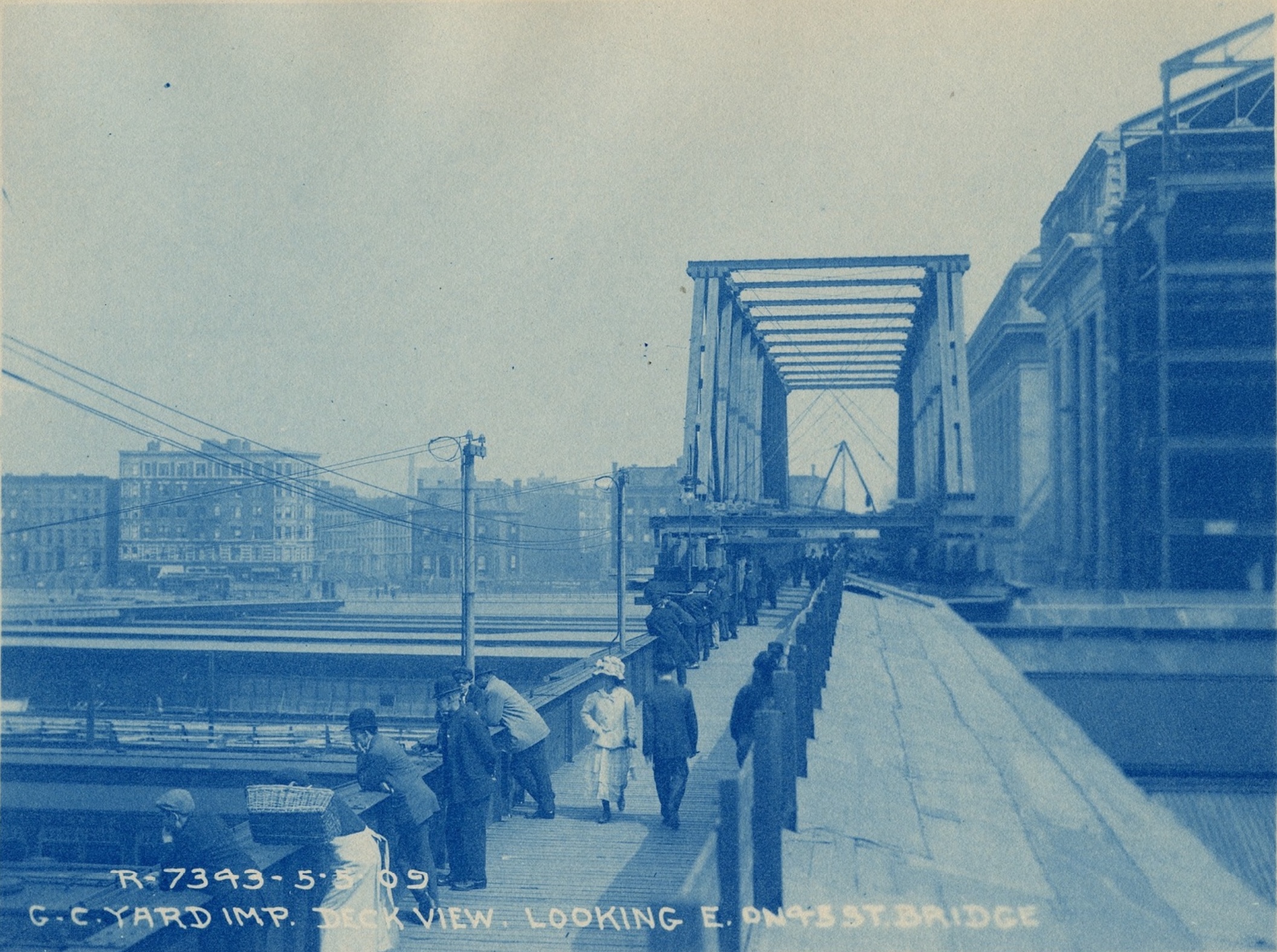
Cyanotype photographs: To view these and additional images in a slideshow with their IDs and credits, click here. Unless otherwise noted, all photographs are from the Grand Central Terminal Collection, 1831-1978, Archives Center, National Museum of American History, gttps://sova.si.edu/record/nmah.ac.1071.
LINKING RAIL TO REAL ESTATE
The composite map on this wall was created by the Museum by combining a 1915 G.W. Bromley Fire Insurance Land Map and a diagram of the tracks of Grand Central Terminal from Engineering News-Record (1920). Fire insurance maps record great detail and are especially useful to historians to document individual buildings, lot by lot, on full city blocks. This map, made in 1909, but updated to 1915, spans the years of the major construction of Grand Central and the double-decked rail yards. It shows that the blocks on the east and west sides of Park Avenue were fully built up, mostly with row houses on single lots. However, north of the terminal, from 45th to 51st Street and from Lexington or Depew to Madison Avenue, many blocks colored yellow await construction.
The diagram of tracks, which can also be seen in full on the wall behind you, is layered onto the land map. This complex diagram shows the layout of the tracks and passages below Grand Central and Terminal City, as well as the passenger platforms, the wide railyard, and the ten tracks that continue north beneath the street. Mapping the tracks in relation to the building sites makes clear the challenges of engineering and constructing multi-story structures without basements and with special foundations that touch down only at narrow points between the railroad tracks.
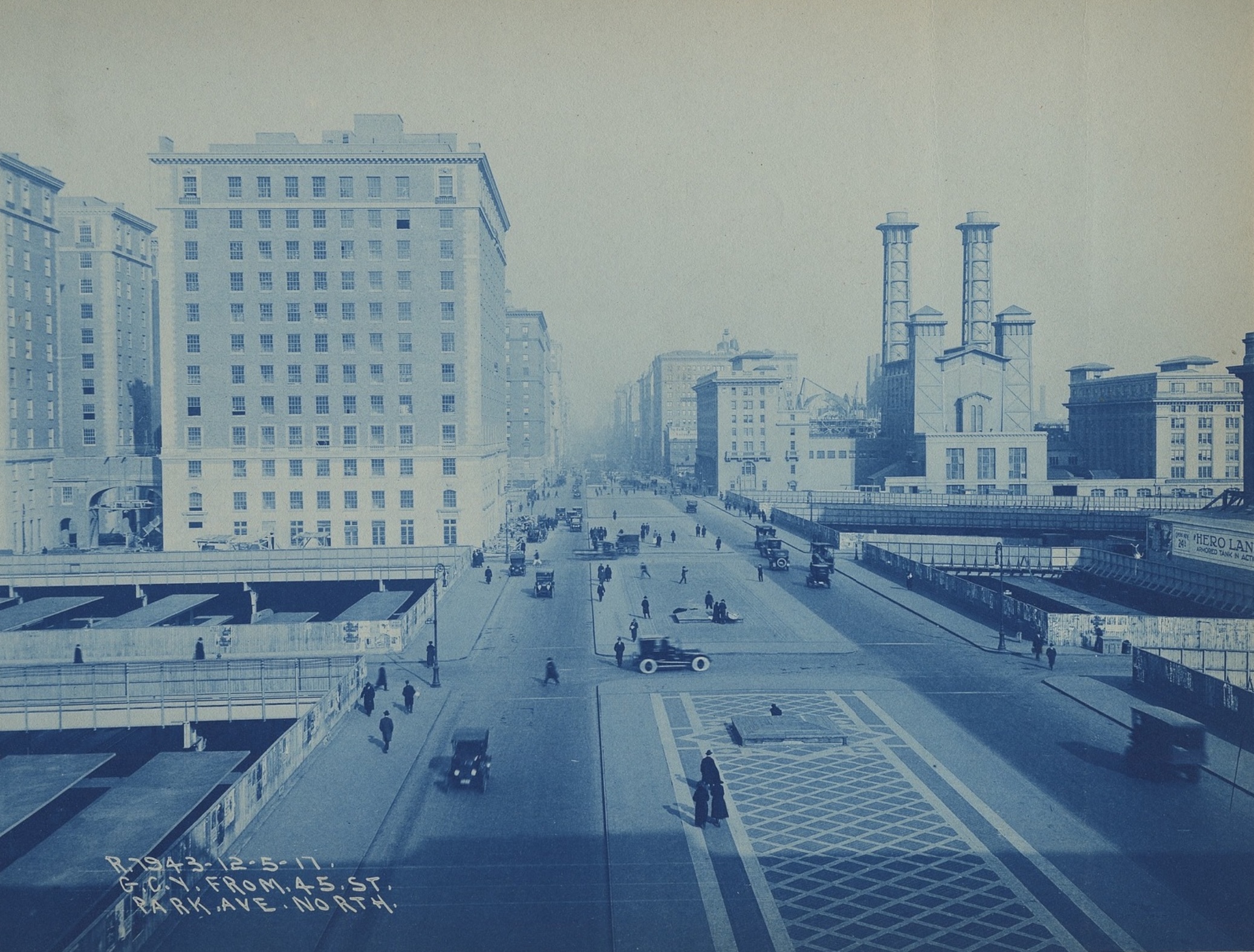
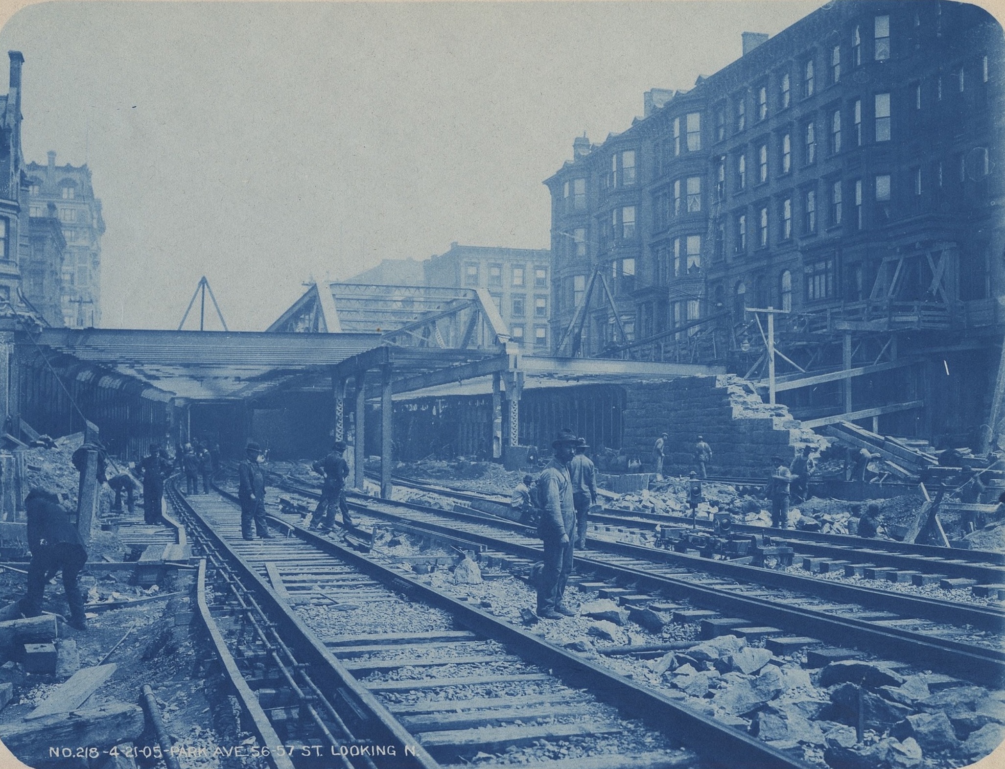
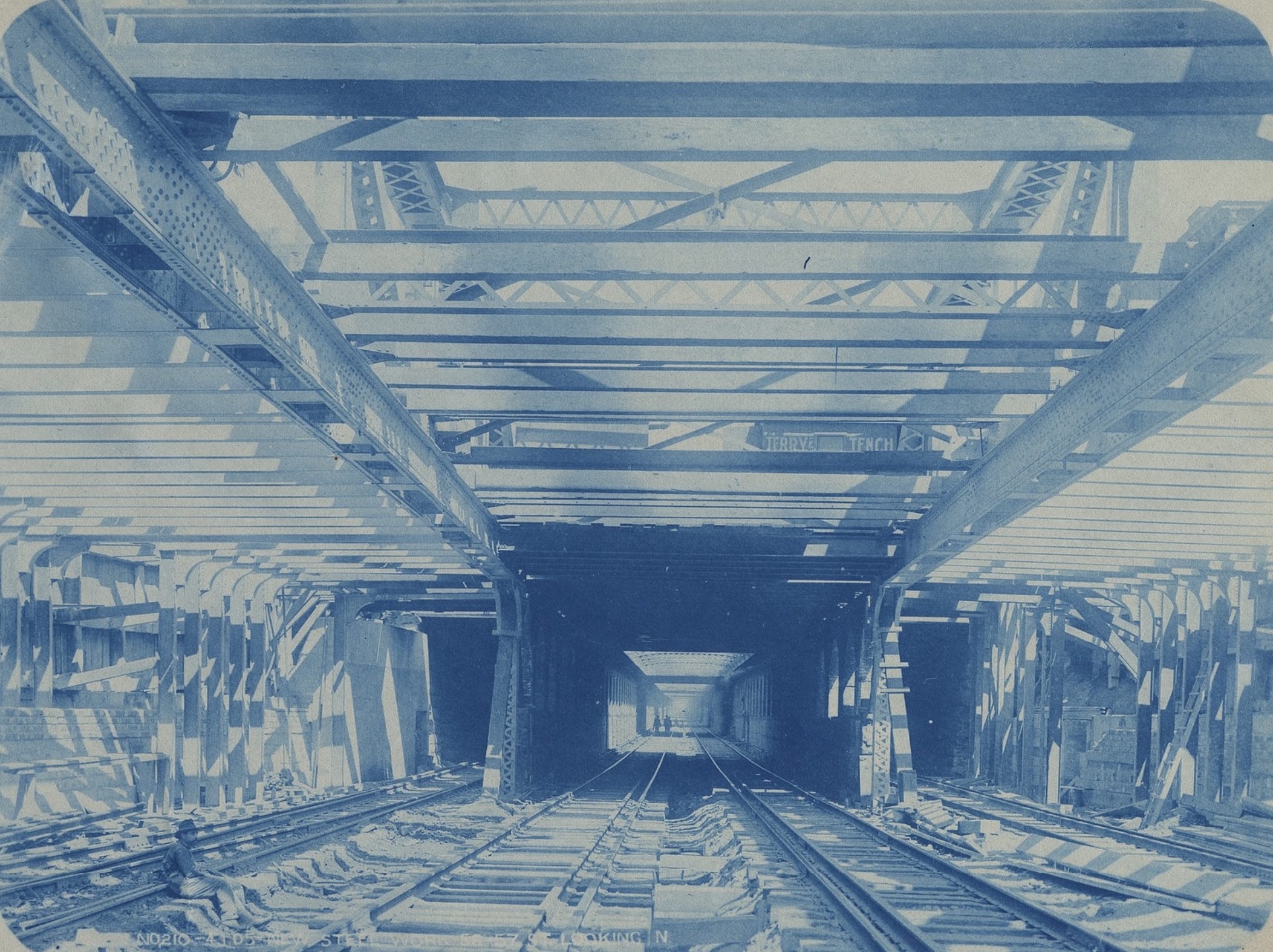
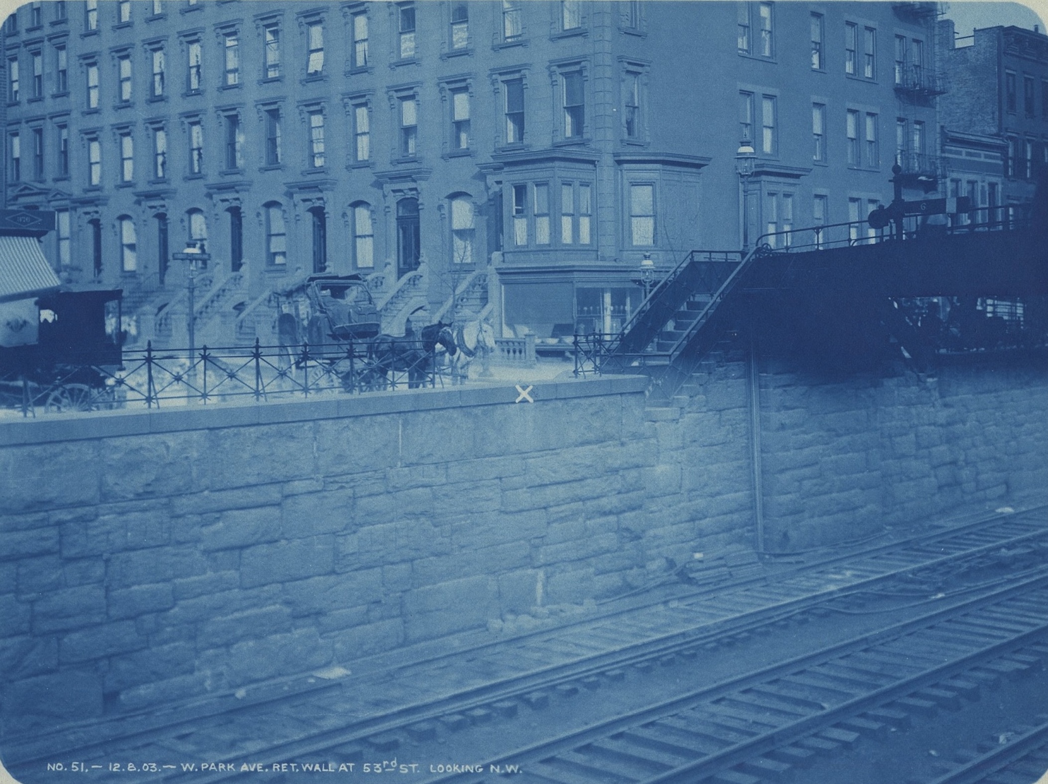
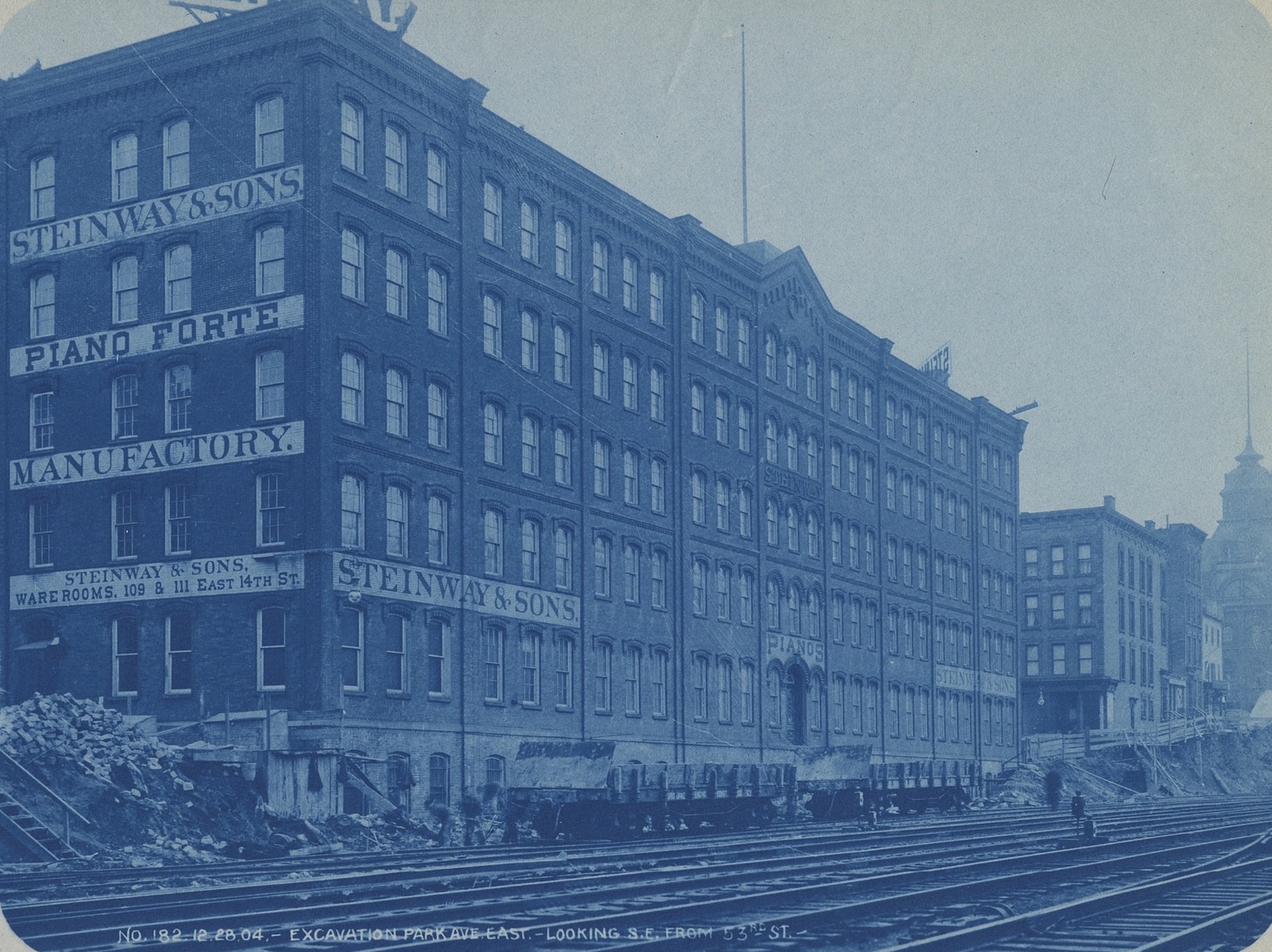
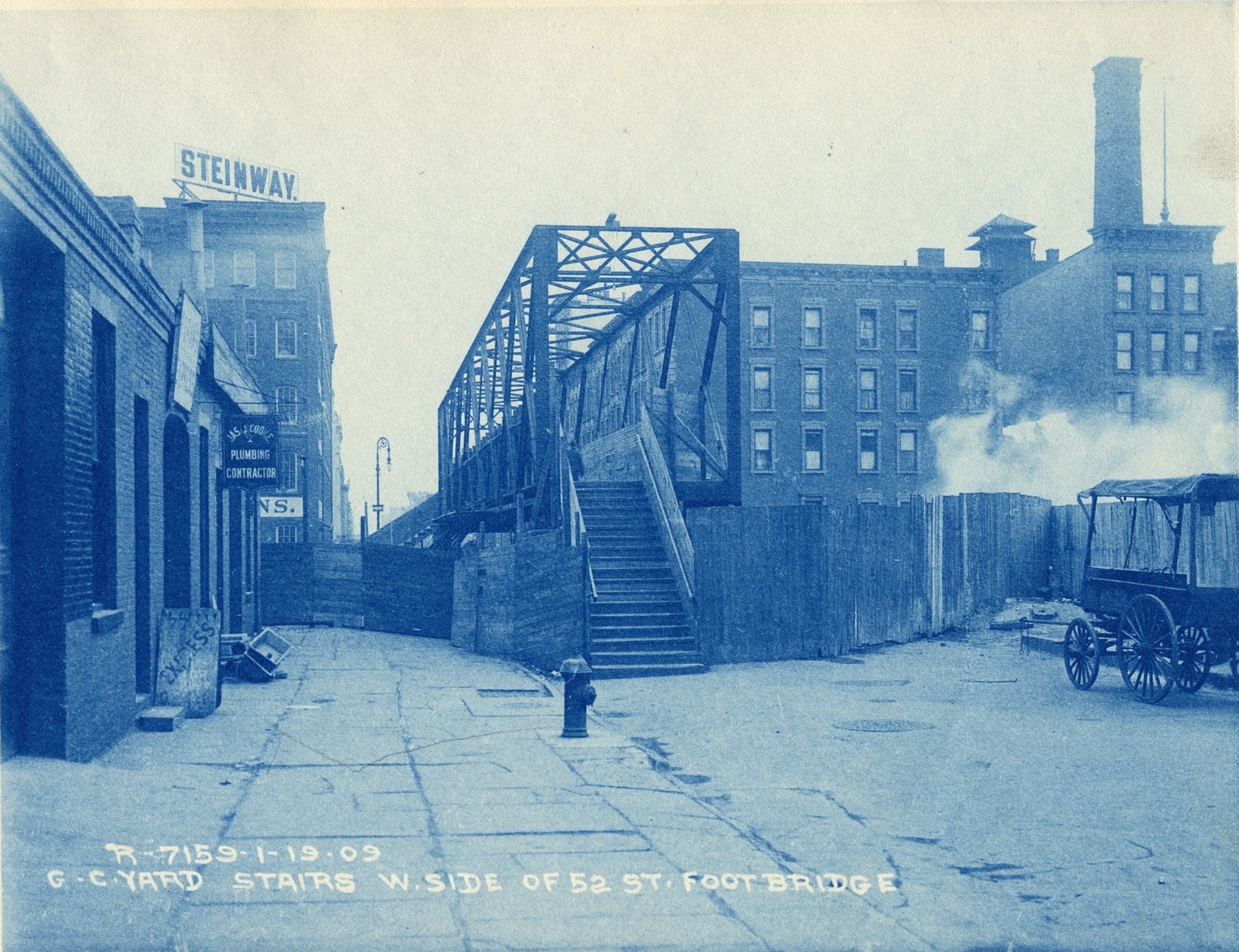
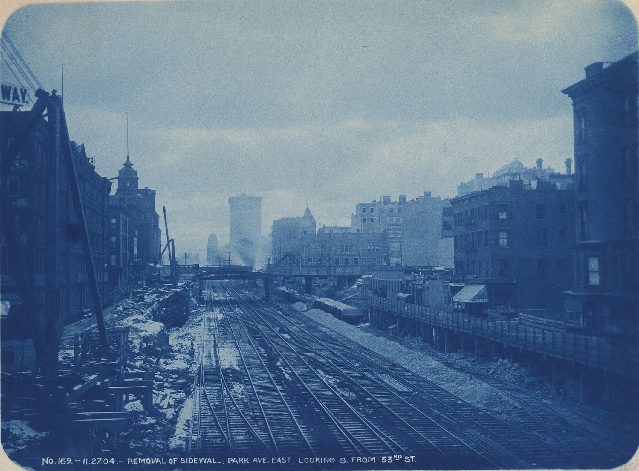
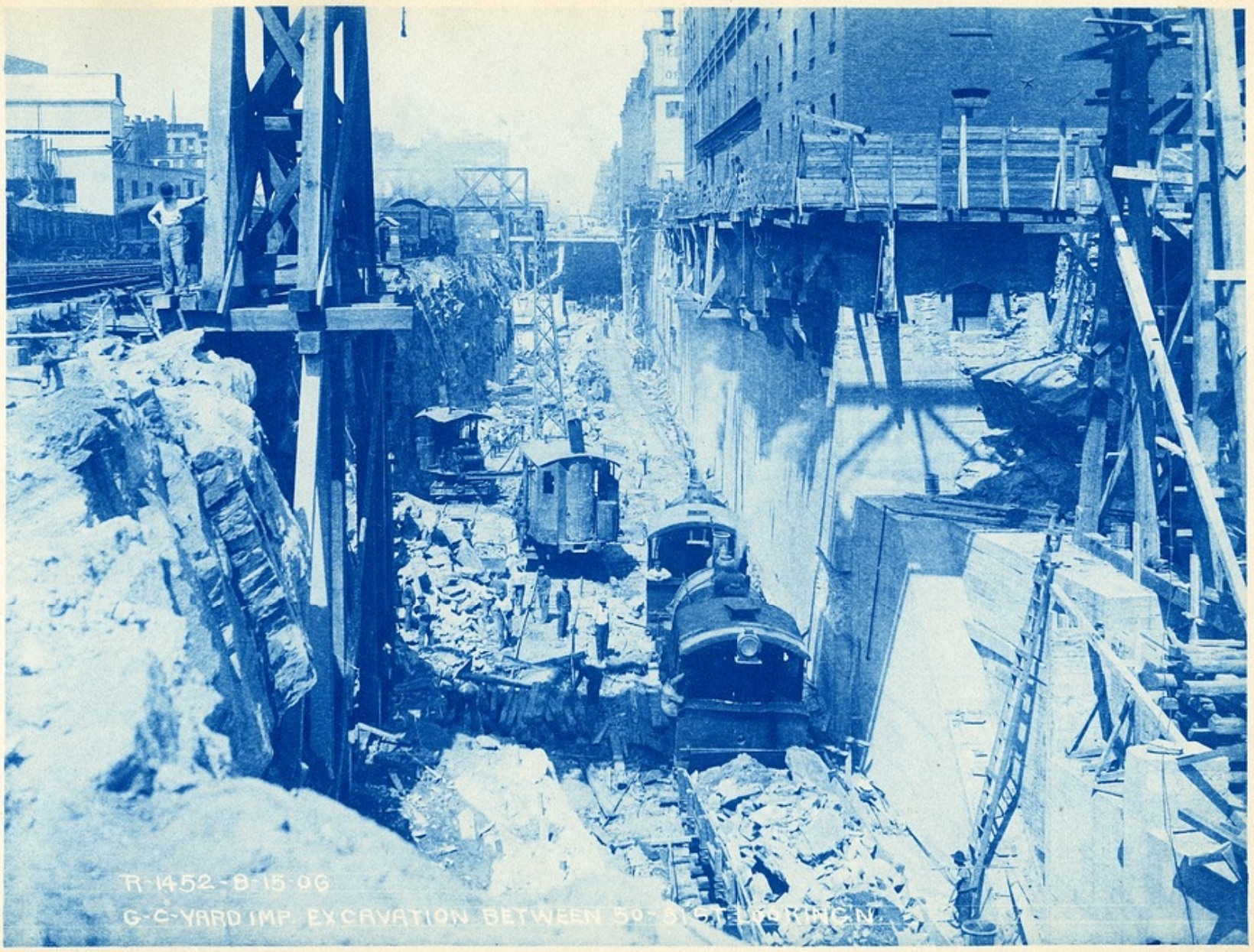
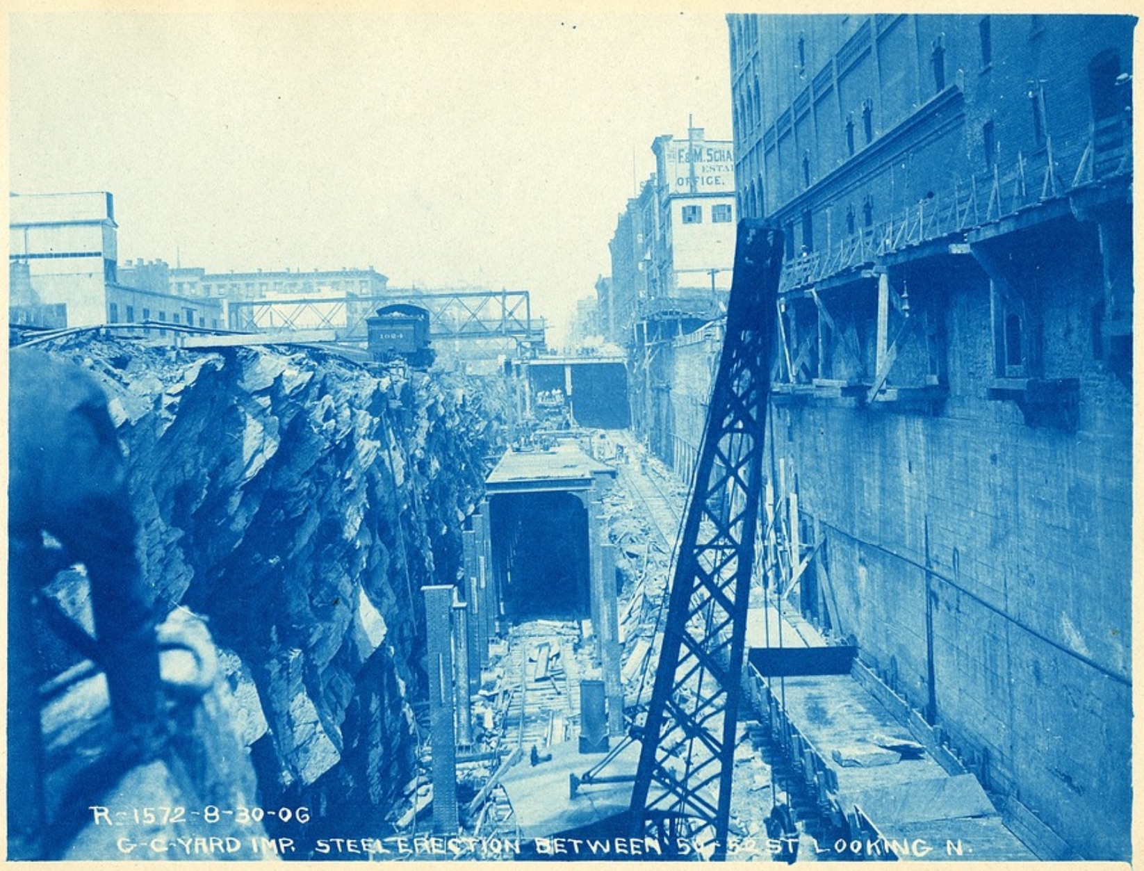
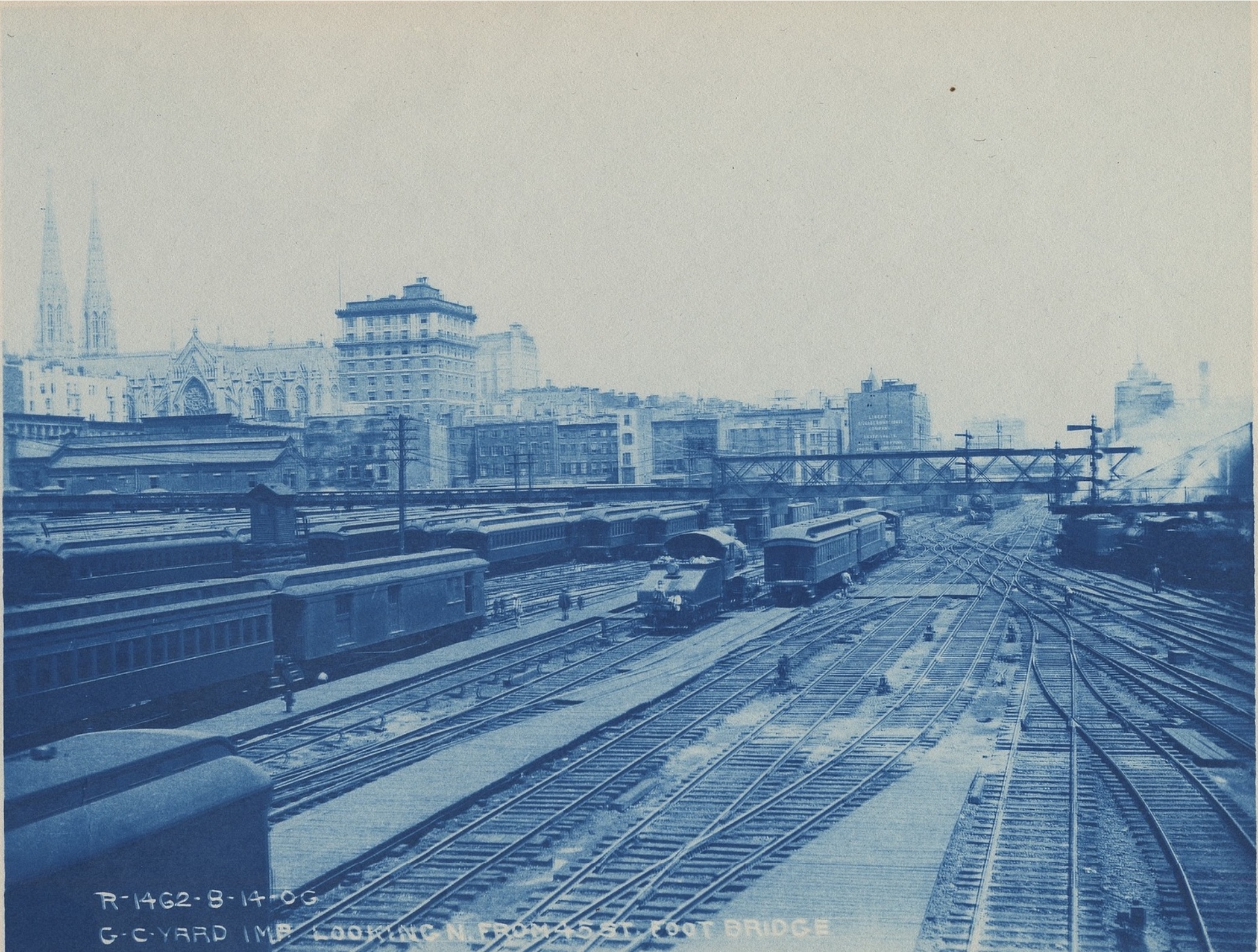
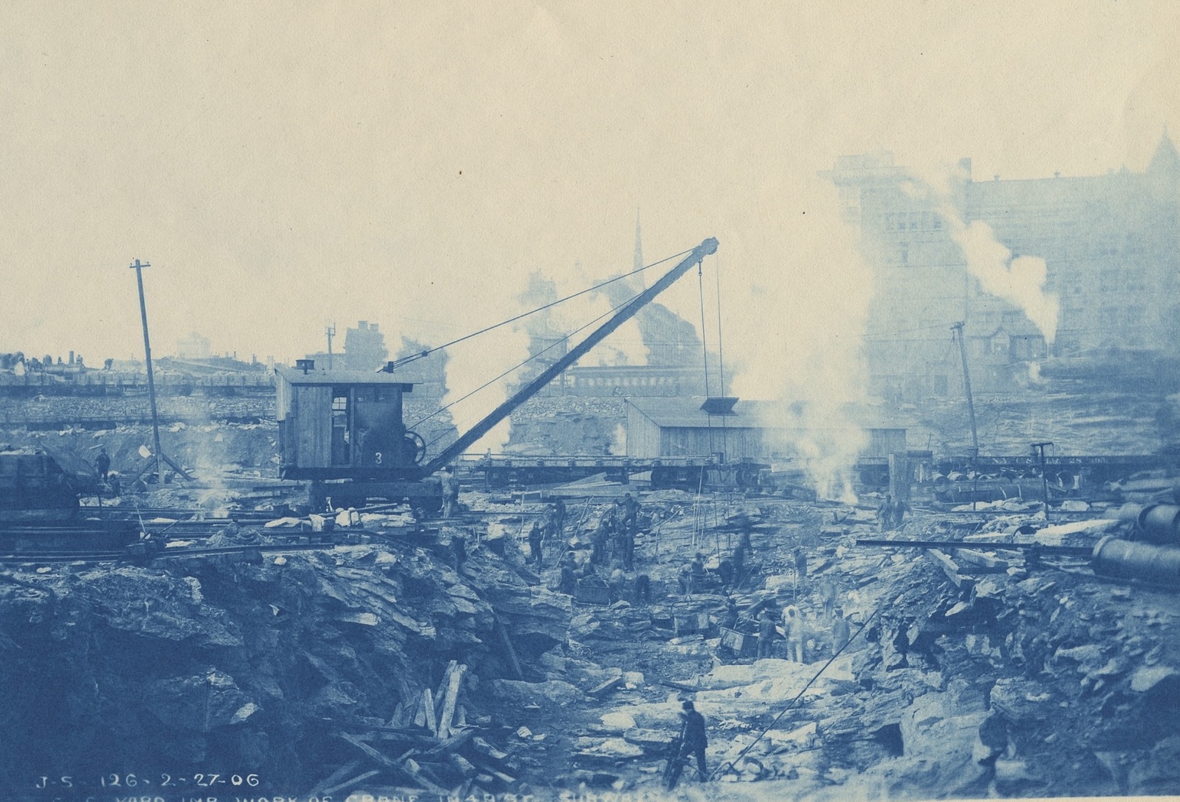
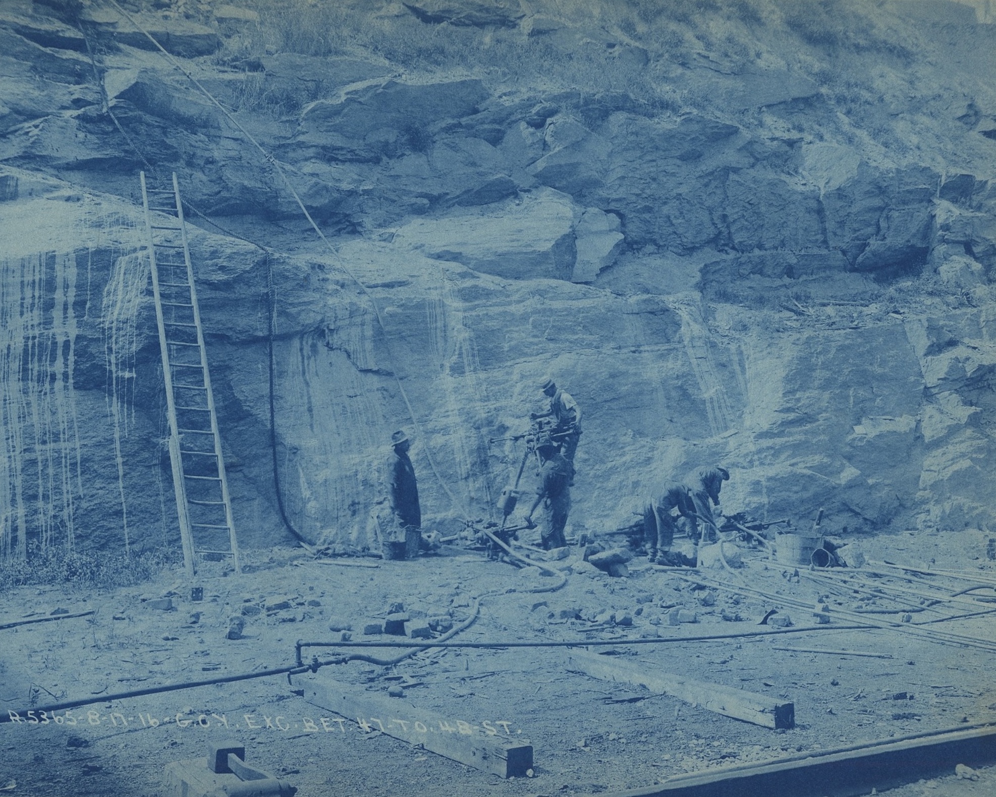
The photographs surrounding the map record many aspects of the excavation and construction work for Grand Central Terminal and Terminal City and span the years from 1903 to 1917. Each image is placed close to the street or location where it was taken, revealing the immense effort over more than a decade. The work included the blasting of rock, the demolition of structures and retaining walls, the removal of thousands of tons of rubble, the laying of tracks, and the construction of steel “bridges” that carry the east-west streets over Park Avenue. The blue color of the photographs is a result of a common, economical method of documenting infrastructure work in the early 20th century called cyanotype.
Land maps, which were used by fire insurance companies to determine premiums, were richly detailed with building information and were usually compiled into a bound book of plates. As each plate illustrated a small section of the city, the Museum digitally stitched together the plates illustrating the area bounded by 42nd Street, 58th Street, Fifth Avenue, and Third Avenue and encompasses the boundaries of Grand Central Terminal and Terminal City, capturing the scene at the moment that the Terminal is completed and as the lots to the north are filled in and readied for buildings.
Map: 1909-1915 Bromley Fire Insurance Map, courtesy of the New York Public Library, overlaid by the Museum on a diagram and map of Grand Central’s new track system from “Grand Central Development Seen as Great Civic Center,” Engineering News-Record 85, no. 11 (1920): 496-504.

King, Moses. King’s Views of New York, pp. 56-57, 1912. Collection of The Skyscraper Museum.


(right) Reed & Stem’s proposal for the terminal building (south facade) 1907. Collection of The Skyscraper Museum. Gift of Andrew Alpern.
(left) Reed & Stem’s proposal for the terminal building (north facade) and the Court of Honor, 1903. Collection of The Skyscraper Museum. Gift of Andrew Alpern.

DESIGNERS OF GRAND CENTRAL
The design of Grand Central Terminal, as built, was the collaboration – often contentious – of New York Central's chief engineer William J. Wilgus and two architectural firms, Reed & Stem and Warren & Wetmore. All phases of their design process, though, were based on the initial concepts that Wilgus laid out in 1903 to the executives of the Central. The key features, which can be discerned in all of the images in this case, included: electrifying and double-decking the tracks into the terminal, all below grade; utilizing the vast area above the tracks for revenue-producing structures; creating a platform to carry a wholly-new Park Avenue and continuous cross streets above the railyard; and building an elevated circumferential road to carry Park Avenue around the terminal and back to grade south of 42nd Street.
By 1904, Whitney Warren had edged out Reed & Stem as sole architects, and the two firms officially became the Associated Architects of Grand Central Terminal. Instead of Reed & Stem’s scheme for a high-rise structure directly above the station, Warren conceived of a monumental gateway to the city, similar in scale and grandeur to McKim, Mead & White’s Pennsylvania Station, then under construction. Warren developed his schemes for the next several years as the work on double-decking the tracks continued. When Wilgus resigned his position at the Central in 1907, after a controversial accident, Warren seized the opportunity to persuade the Central’s executives to change direction. In 1909, the board met and authorized Warren’s scheme. The final plans were filed on January 13, 1911.
The design of the station and broader vision for Terminal City depicted in the renderings published in 1912 in King’s Views, in Scientific American, and on the stock certificate for the bonds that financed the construction of the complex, reflect both the original Wilgus concept and, as Peter Pennoyer and Ann Walker, authors of the definitive monograph on Warren & Wetmore, wrote, “a synthesis of Reed’s practical planning and Warren & Wetmore's architectural genius.”

View south of 50th Street of Grand Central Terminal, 1913, Box 8, Folder 6, Grand Central Terminal Collection, Drawings and Archives, Avery Architectural & Fine Arts Library, Columbia University.

AIR RIGHTS
Photographs of the construction of the terminal in 1912 and of the platform of Park Avenue in June 1913 make clear the immense scale of the work, as well as the grid of steel that undergirds the entire complex. The terminal building itself was a steel-frame structure, clad in stone to create a monumental classical appearance. Its massive scale filled and dominated the block and gave the station a dignified civic presence, thanks to the insistence and influence of Whitney Warren over the New York Central’s executive board.
The large photograph of the construction of the platform of Park Avenue, dated June 23, 1913 – four months after the station opened to the public – reveals the many open, empty blocks north of 45th Street. On the west side (at right), one can see levels of the excavation still underway. On the east side (at left), the upper-level tracks splay out to serve the station's many platforms.
The blueprint map was prepared by William Wilgus and is reproduced from his papers at the New York Public Library. Inscribed ‘39, he probably prepared it for the long paper “The Grand Central Terminal in Perspective” that he published in January 1941 in the Transactions of the American Society of Civil Engineers. After Wilgus resigned from his position as the Central’s Chief Engineer in 1907, others began to take credit for his work and ignore his seminal role in the design. His long article was intended to set the record straight as to the original features of the project. The concept of air rights developed with revenue-producing properties, which is illustrated by his map of the inner and outer zones of Terminal City, was, by the 1940s, a proven success.